Mapping


Jenny Rechel, Wildlife Biologist / Geographer

- Ph.D., University of California
- USDA Forest Service Scientist
- As a wildlife biologist and geographer, I focus on studying the effects of disturbance (fire, post-fire erosion, and drought) on bird populations and habitats in the National Forests in southern California.
- Ph.D., University of California
- USDA Forest Service Scientist
- As a wildlife biologist and geographer, I focus on studying the effects of disturbance (fire, post-fire erosion, and drought) on bird populations and habitats in the National Forests in southern California.


Christie Hawley, Natural Resource Analyst

- M.N.R., University of Georgia
- USDA Forest Service Scientist
- As a natural resource analyst, I gather geographic and field data on forests and wildland fires. I analyze these data using computer software to answer scientific questions related to fire and plant interactions.
- M.N.R., University of Georgia
- USDA Forest Service Scientist
- As a natural resource analyst, I gather geographic and field data on forests and wildland fires. I analyze these data using computer software to answer scientific questions related to fire and plant interactions.


Kelsey Aho, Alaska Region GIS Coordinator

- M.A., University of Alaska, Fairbanks
- USDA Forest Service
- A geographic information systems (GIS) coordinator supports resource specialists and the public in the use of geospatial technology such as maps and apps for land, natural resources, and ecosystem management.
- M.A., University of Alaska, Fairbanks
- USDA Forest Service
- A geographic information systems (GIS) coordinator supports resource specialists and the public in the use of geospatial technology such as maps and apps for land, natural resources, and ecosystem management.


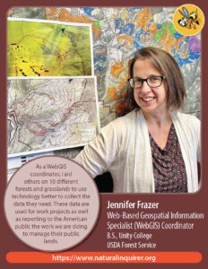
Jennifer Frazer, Web-Based Geospatial Information Specialist Coordinator

- B.S., Unity College
- USDA Forest Service
- As a WebGIS coordinator, I aid others on 10 different forests and grasslands to use technology better to collect the data they need. These data are used for work projects as well as reporting to the American public the work we are doing to manage public lands.


Todd Kellerman, GIS Specialist

- B.S., University of Nebraska-Lincoln
- USDA Forest Service Scientist
- As a GIS (Geographic Information Systems) Specialist I use software to collect, analyze, and model geographic data to create maps.
- B.S., University of Nebraska-Lincoln
- USDA Forest Service Scientist
- As a GIS (Geographic Information Systems) Specialist I use software to collect, analyze, and model geographic data to create maps.


Sabry Hanna, Geologist

- Ph.D., Cairo Univeristy (Egypt)
- USDA Forest Service Scientist
- Geology is the study of Earth, the materials of which it is made, the structure of those materials, and the processes acting upon them. An important part of geology is the study of how Earth’s materials, structures, processes and organisms have changed over time.


